The Czech Geological Survey (CGS) has been developing its Geological Information System (GeoIS) over the long term as a part of the Unified Environmental Information System (JISŽP) and also to provide support for CGS operations and management.
Geological information system
Main goals of GeoIS development
- Unification of the development and use of information technology throughout the CGS
- Obtaining, processing, storing and providing information on past and ongoing geological projects, their outputs and acquired geological data, on written documents and samples, and on professional geologists
- Unified collection, management and provision of geoscientific information to the general and professional public
- Support for activities and improvent of CGS presentations
- Ensuring compatibility with the environmental information system of the Ministry of the Environment of the Czech Republic and with European or global data infrastructures (INSPIRE, EGDI, etc.)
GeoIS outputs
CGS Metadata catalogue is the central access point to search information (metadata) about data sources that are maintained and provided for public by the Czech Geological Survey. It is based on MIcKA system, which enables the user to work with metadata of spatial data in accordance with international standards (ISO, OGC and INSPIRE). Metadata are administered centrally in a database, edited and viewed through a web interface, and published by means of a standardized catalogue service (CS-W).
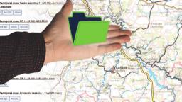
National Geological Map Database of the Czech Republic
A significant part of the GeoIS is the National Geological Map Database (NGMD), which is a comprehensive knowledge database including all data and information stored in professional map archives and which also serves as a data repository for geoscience data and information from contemporary geological mapping programmes at various scales. The NGMD is part of the central data warehouse of the CGS and contains the following parts:
GEOCR25 – a geodatabase of maps at 1:25,000 scale – is based on geoscience vector maps that have been produced since 1999, covering roughly one-third of the Czech Republic (comprising geological maps and, since 2007, also maps of mineral resources, environmental geofactors, hydrogeological maps, etc.). Documentation databases (database of documentation points for geology and hydrogeology) and a lithogeochemical database are included as well. For the geological maps, a unified legend is created for “mapped areas“ (such as the Moldanubicum, Brno agglomeration, etc.). The legend also includes stored cartographic representations of geological units.
Geological maps are publicly available in the Geoscience Maps 1:25,000 application (Czech only).
GEOČR50 – a geodatabase of maps at 1:50,000 scale – is based on geological vector maps covering the entire Czech Republic (214 map sheets). The maps have undergone three modification phases (linking to a topographic base, “map stitching“, unification of geological units, etc.). The data model of the geodatabase is based on a unified legend.
GEOČR50 is used by public authorities, government agencies, and so forth. The geology layer serves as a base layer for several national thematic layers (hydrogeology, soils, radon risk, etc.). The geological maps are publicly available in the Geoscience Maps 1:50,000 application (Czech only).
GEOCR200 – a geodatabase of maps at 1:200,000 scale – is based on geological vector maps covering the entire Czech Republic, which are vectorized “general maps“ (only of the Czech Republic), created until 1965. They are linked with a unified legend.
GEOČR500 – a geodatabase of maps at 1:500,000 scale – is based on a geological vector map published in 2008, which is linked to a unified legend.
Map archive is a digital map archive created in 2000–2004, comprising 50,000 published and unpublished geoscience (manuscript) maps, including related explanatory notes and graphic documentation, which were digitized. The map archive is continuously updated.
You can search for data from the archive in the Digital Map Archive application, as well as for maps from all over the world. You can search for maps from the Czech Republic in the Map Archive of the Czech Republic application.
International cooperation
The staff members of the Information Systems Division are also engaged in international projects focusing on the development and maintenance of thematic cross-border data infrastructures. They are members of various international working groups or consortia as well.
EGDI is EuroGeoSurveys’ (EGS) European Geological Data Infrastructure. It provides access to Pan-European and national geological datasets and services from the Geological Survey Organizations of Europe. EGDI is a central element in EGS’ ambition about establishing a Geological Service for Europe.
Select projects conducted
geological data and knowledge of two geological surveys in Bosnia and Herzegovina, in
line with the UN 2030 Agenda for Sustainable Development. Project aims are to
support the public institutions in improving the geological information system, to
increase professional competence of local experts and governmental staff and to
improve data management, access, presentation and dissemination of data and
information."


