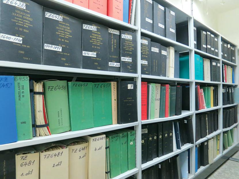
Within the scope of executing tasks of the national geological survey and in terms of Act No. 62/1988 Coll., on geological projects, the archives permanently store and provide access to geological documentats and geological project results. Each year, several thousand final reports from newly conducted geological surveys are submitted to the archives. Reports on CGS research activities and geoscientific maps are included in the collections as well. All new additions are processed, and selected data are included in the scientific inventories and databases of the geological information system. The collections are, by prior request, availabe to visitors at the CGS study room, and digitized reports are also available in an online browser. The CGS Photo Archive provides access to extensive historical and contemporary photographic documentation produced by the CGS in the Czech Republic and abroad.
Archives
Archive applications

ASGI - Automated System of Geological Information application allows unified access and parametric search of reports and opinions saved in all CGS archives. It’s primarily documentation of Geofond department archive under the Act of geological projects and expert outputs from organization since it’s foundation. Besides detail information about reports allows thumbnail of digitized documents. Some documents from another geological organizations archives are also available.
Database application of digital map archive contains a large collection of geoscientific maps and manuscript documents from the Czech Republic and the world. Map documents are mainly produced by CGS and its predecessors. It is possible to carry out detailed searches using map applications by means of which previews of digitized documents and other detailed information can be obtained (explanation, legend, geological cross sections, etc). For most of the map is available on-line thumbnails.
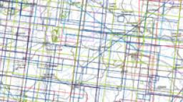
Map application allows location and displaying maps from the Czech Republic, which are stored in the archive of the CGS. The result of the search is a bibliographic information and a link to the preview of scanned maps.
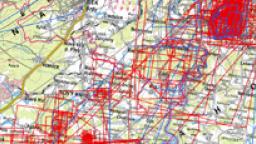
Map application gives access to previews of scans and information on mining maps of the Czech Republic registered in the CGS workplace in Kutna Hora.
This map server application presents two sets of old geological maps from the area of Bohemia and Moravia – manuscript geological maps at a scale of 1 : 28,800 and printed geological maps at a scale of 1 : 144,000 (so called Haidinger maps). Attributes available for manuscript maps: title of the map sheet in Czech and German, information about the author and date of creation (if it is available), link to a file with geological legend (if it is available) and links to map archives of CGS and GBA. Attributes for printed maps: title of the map sheet, name of the author and link to the CGS map archive.The manuscript maps are published on CGS map server with the permission of the Archive of the Geological Survey of Austria (GBA).
CGS photo archive application makes large historical and contemporary photographic documentation of the CGS from the Czech Republic and abroad accessible to public. This application allows the user to search photos according to the information about the author, year of origin, localization (based on administrative units), geological classification, geological age and geological localities. Predefined galleries (series of thematic images) are available as well (e.g. Lipno dam construction 1958–1959 or Expedition to the Antarctic 2004–2009).
Reports and Assessments Archive – Geofond
The archived collections of reports and assessments are divided into thematically focused signature series. Searches are possible via the ASGI application, which provides access to records with detailed information on the content of documents.
General archive collections
- Reports and assessments (signature series “GF P“, “GF V“) – documentation of geological, hydrogeological, engineering geology, economic geology, geophysical, geoecological and radon surveys, including mineralogical, petrographic, physical, chemical and technological analyses, and borehole documentation.
- Resource reports collection (signature series “GF FZ“) – documentation of economic geology surveys with estimates of mineral or groundwater reserves. The collection has been stored separately since 1952.
- Foreign trips (signature series “GF ZC“, “CGS ZC“, “ITG“) – reports on geological surveys outside the Czech Republic and travel reports.
- Material produced by the CGS (signature series “CGS P“, “CGS R“) – unpublished results of the institute‘s scientific activities, results of conducted projects, processed estates of prominent geologists.
Contact: Mgr. Milada Hrdlovicsová
Brno Geophysical Archive
The Geophysical Archive (signature series “GEOF“ ) contains the results of geophysical measurements carried out primarily by “Geofyzika, n.p. Brno“ and its successor organizations since the early 1950s, including research, study and methodological work conducted in the Czech Republic and abroad. The collections are located at the CGS office in Brno. Majority of the reports are digitized.
Contact: RNDr. Eva Hudečková
Jílové u Prahy Centre for Documentation of Gold Deposits
Original written and graphic geological documentation from activities involving prospecting, mining and thematic surface geology mapping, historical maps and samples from gold-bearing districts (signature series “JIL“ ). The centre is located in the Regional Museum in Jílové u Prahy and is accessible by prior arrangement. It is also possible to arrange for documents to be delivered to the study room in Prague.
Contact: RNDr. Alan Donát
Kutná Hora Archive and Library of Historical Mining Documents
A collection of historical mining documents related to mining, geosciences and history. By prior arrangement, visitors may study the written material and maps at the library and archive located at the CGS office in Kutná Hora. The mining maps archive is directly available in digital format via the Mining Maps application.
Contact: Mgr. Jolana Šanderová
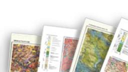
Map Archive
The Map Archive holds collections of geoscience maps, which include various thematic maps and map supplements from the Czech Republic and abroad, as well as historical maps and map outputs produced by the CGS. The map collections are largely digitized and available in online previews, and printed originals can be studied by prior appointment in the CGS study room. The collections also include a separate archive of mining maps.
Maps of the Czech Republic
A significant part of the map collection consists of maps of the Czech Republic (or Czechoslovakia). It mainly includes printed maps, which were produced primarily as outputs from the scientific activities of the geological institute since its founding in 1919 until the present day. Additionally, the collections also include manuscript maps or original field documents. Thematic maps include geological maps, Quaternary maps, mineral deposit maps, geophysical maps, soil maps and many other special-purpose maps.
Foreign maps
More than half of the map collection consists of printed maps and explanatory notes from more than 200 countries throughout the world. Most of the geoscience maps come from European countries (such as Germany, Austria, Slovakia, Poland, etc.), followed by the countries of America, Asia, Australia, Africa and Antarctica. The collection also includes map outputs from foreign projects involving CGS geologists, such as mapping projects in Mongolia, Nicaragua, Costa Rica, Zambia and other countries.
Historical maps
These map files are accessible via the History of Geological Mapping of the Czech Republic application.
The oldest original map in the CGS collections is a map from 1835, whose authorship is attributed to A. Preininger. An interesting part of the collections includes, for instance, geological manuscript maps from the second half of the 19th century at 1:28,800 scale and geological maps of the Bohemian Kingdom at 1:144,000 scale (referred to as Haidinger maps), from which a stitched map layer was produced from digitally processed images during a collaborative effort of the archives of the CGS and GBA (Geologische Bundesanstalt, Vienna).
Contact: Ing Katarína Černá
Archive services
Archive loans – study room
- Archived documents can be studied / viewed / examined for a fee only in the study room located at Kostelní St. 26, Prague 7. Most of the collections are stored in the Prague repository. The availability of reports stored in external repositories depends on delivery circumstances. Information on storage location is given under “Repository“ in the ASGI records. Digitized reports can be viewed free of charge on monitors in the study room.
- Each visit to the study room must be scheduled in advance at zakazky@geology.cz
- When scheduling a visit, you must indicate the signature series of the required documents, the date and time of your planned visit (7:30–11:30 or 12:00–15:00), and you must wait for the date of your visit to be confirmed upon making your request.
Reprographic services
Black and white and colour copies, up to A3 format, of the archived material can be made using a self serve copier in the study room. Larger format attachments can only be provided in digital format.
Service fees
Services provided by the archives are subject to a fee.
Contact: Ing. Michaela Hlubučková
Digitization and remote access to archived reports
More than 50,000 archived reports (over 4 million pages in total) are already available online. Remote access in an online browser is provided upon registration at data@geology.cz and payment of an annual operating fee of CZK 1,000.
Obtaining digital copies of archived documents without registering
For documents that have not yet been digitized, or if a person does not wish to use the online access registration, a complete digital copy or selected pages can be ordered individually at data@geology.cz (with payment by invoice). The scans are then sent electronically in the agreed format (PDF, JPG) to the person making the request. In this case, the above-mentioned services are subject to a fee, and the price is calculated per page (1 A4 page / CZK 10).
Contact: RNDr. Renata Kachlíková, Mgr. Pavla Kramolišová
The digital collection of the Map Archive
is available via the Digital Map Archive and Mining Maps applications.
CGS Photo Archive
The CGS Photo Archive provides access to an extensive collection of historical and contemporary photographic documentation produced by the CGS in the Czech Republic and abroad. The application allows you to search for photographs by author, year, administrative units and by geological subdivision, geological age and geosites. Also available are assembled photo collections series of thematic photos (such as Construction of Lipno Reservoir 1958–59 or Expedition to Antarctica 2004–09).
Contact: RNDr. Tamara Sidorinová