The Czech Geological Survey (CGS) provides the state geological service as authorized by the Ministry of the Environment (MoE). Over the long term, it systematically maintains the thematic databases of underground mines, abandoned mine lands, impacts of mine workings and mining maps. Information from the databases serves professionals, public authorities and land-use authorities and to process land-use analysis documents.
Underground mines and abandoned mine lands
Related web applications
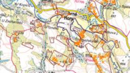
This map application Mining impacts (Abandoned Mine Lands, Underground Mines) displays basic information about mine workings, undermined areas and sites used for the disposal of mining waste in the same map window.
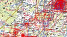
Map application gives access to previews of scans and information on mining maps of the Czech Republic registered in the CGS workplace in Kutna Hora.
Maintained inventories and databases
Underground Mines Database
Management of the Underground Mines Database is based on the necessity of maintaining an inventory of basic data on individual underground mines in the Czech Republic. An underground mine is any mine working which opens to the surface and which is driven for the purpose of extracting a reserved deposit or its integral part.
Abandoned Mine Lands Database
Management of the Abandoned Mine Lands Database is carried out according to the provisions of section 17 of Act No. 62/1988 Coll., on geological work, as amended. These areas may influence the preparation of land-use plans and affect the environment. The CGS provides data on geohazards to public authorities and land-use planning authorities for the purpose of processing land-use analysis documents.
Impacts of Mine Workings Database
Management of the Impacts of Mine Workings Database is one of the key activities. Mine working impacts refer to subsurface mines or open pits, which are abandoned and whose original operators or legal successors do not exist or are unknown.
Mining Maps Database
The Mining Maps Database currently contains more than 18,000 records, comprising maps and plans related to mining in the Czech Republic. They include original maps and various copies of printed and manuscript maps. Most of the maps were created in the 20th century, but there are also maps from the 19th century (more than 1,000), the 18th century (nearly 350) and the 16th17th centuries (nearly 20). Basic data and specific map previews via a publicly accessible web application are available for all maps that are digitized and that include a spatial reference.
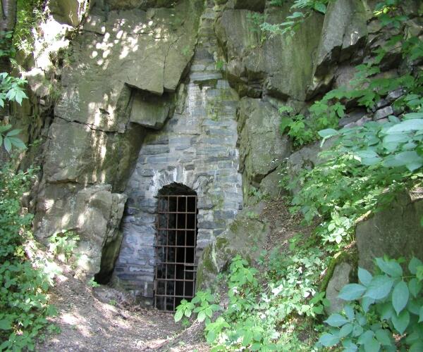
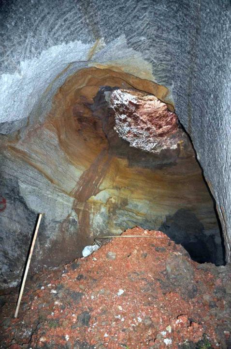
Sealed mouth of the Poličany Adit (Kutná Hora District).
|
Author: Archiv ČGS
Underground mines
The database contains a range of basic information on each site as well as relevant documents, such as map sections, photographs and diagrammes. In addition to dealing with the above-mentioned mine working impacts, the database is mainly used for drafting land-use plans and for monitoring the safety of mine workings. Currently, the sites of subsurface mines are depicted by standard symbols on maps of abandoned mine lands.
The number of inventoried mine sites is not definitive. The data are continuously updated and supplemented as new sites are identified. The database contains more than 26,000 sites and more than 25,000 graphic attachments (2023).
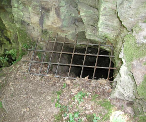
Sealed adit entrance near Spálený mlýn (Kutná Hora District).
|
Author: Archive CGS
Abandoned mine lands
The original inventory of abandoned mine lands was developed in 19831985. Monitored data were gradually transferred into a unified database, and map entries and data are continuously updated based on expert assessments and reports. The Abandoned Mine Lands Database of the Czech Republic currently contains data on more than 5,000 sites of abandoned mine lands.


Impacts of mine workings
According to the Mining Act, mine working impacts refer to abandoned underground mines, whose original operators or legal successors do not exist or are unknown. According to an amendment adopted in 2002, the impacts also refer to abandoned open pits, whose original operators or legal successors do not exist or are unknown.
The duty to report mine working impacts applies to everyone. All reports received are entered into an inventory of mine working impacts. The reported sites are classified into specific categories after being inspected by the CGS.
The following categories apply:
- Impacts of mine workings (SDD) as defined in section 35 of the Mining Act
- Abandoned exploratory mine workings (OPDD), funded by the state for geological exploration purposes and not developed for subsequent mining
- Abandoned mine workings (ODD), workings no longer in operation, which have owners or legal successors
- Other sites, mainly subsurface openings driven for purposes other than mining and mineral exploration
If a mine working impact poses a threat to public interest protected by law, the state assumes responsibility for its necessary remediation via the MoE.
Data from the inventory of mine working impacts are simultaneously entered into the Impacts of Mine Workings Database, which is part of the CGS Information System. The Impacts of Mine Workings Database contains more than 3,000 individual reports (2023) including over 3,000 mine working impacts.
Information on the location and status of mine working impacts is mainly used for expert assessments involving land-use planning. Data on individual mine workings and their impacts are provided as basic information in CGS web applications.
Mining maps
The Mining Maps Database is continuously updated. First of all, it contains maps from the “original“ collection of the CGS, which includes original maps and various copies of printed and manuscript maps held in the CGS Archive in Kutná Hora. The database also contains maps that are stored at the Centre for Gold Deposit Documentation (a CGS office) in Jílové u Prahy and maps that are on loan for digitization purposes from other archives, such as the Moravian Provincial Archive in Brno, the Provincial Archive in Opava, the State Regional Archive in Prague, and the State Regional Archive in Zámrsk, and mining maps from various company archives.