HomeAbout UsCurrent Events
Czech Geological Survey Assists In Ethiopia: Results And Maps On A New Website
Czech Geological Survey assists in Ethiopia: Results and maps on a new website
Czech Geological Survey assists in Ethiopia: Results and maps on a new website
Kryštof Verner
Since 2015, the Czech Geological Survey (ČGS) has been operating in Ethiopia as the leading institution in an international team under the leadership of Dr. Kryštof Verner. The activities focus on geological, hydrogeological, and soil mapping with broad implications for the sustainable management of vital natural resources such as soil, water, and raw materials. An essential goal of these development activities is also to strengthen the expertise of Ethiopian institutions and universities.
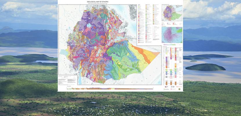
The newly launched project website, Czech Development Cooperation on Geoscience in Ethiopia, provides an overview of the results of development projects in Ethiopia funded by the Czech Development Agency. Visitors can access new online interactive mapping applications, including the national geological and hydrogeological maps of Ethiopia at a scale of 1:1,000,000, along with a full range of maps and scientific publications.
By sharing the Czech expertise across various geological disciplines, this initiative contributes to understanding and addressing global challenges in an international context. This is evidenced by the recent publication of the geological and hydrogeological map set Geological and Hydrogeological Map of Ethiopia 1:1,200,000 and the accompanying publication A Synopsis of the Regional Geology and Hydrogeology of Ethiopia."