HomeAbout UsCurrent Events
The Second Series Of Geoscientific Mapping Trainings Of The PanAfGeo2 Finished In Uganda
The second series of geoscientific mapping trainings of the PanAfGeo2 finished in Uganda
The second series of geoscientific mapping trainings of the PanAfGeo2 finished in Uganda
Mgr. Veronika Štědrá, Ph.D., Leader of the WPA, PanAfGeo2
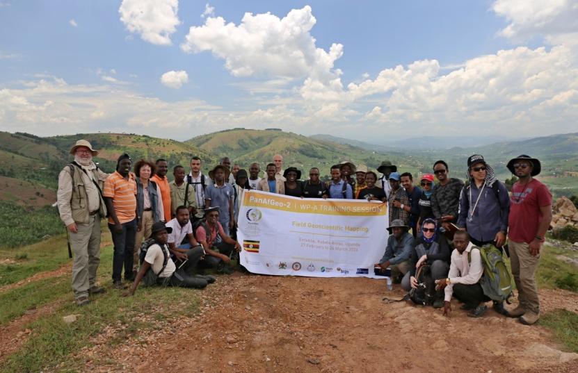
The second series of the international programme PanAfGeo2 (2021–2024) and its section Geoscientific Field Mapping (WPA) has been completed by the last 12th geological mapping training in Africa on the 26th March 2024 under he leadership of Veronika Štědrá, CGS. The training was launched under cooperation between the Czech Geological Survey and the Department of Geological Survey of Uganda in Entebbe, with the field part in mountain area of Kabale in the SW part of Uganda. The geological mapping is a hot topic throughout African geological surveys, as most of the territory is mapped on a general scale only and the detailed mapping is urgently required in the most of African geological surveys though lacking own capacities. One month long mapping trainings are appreciated by African trainees thanks to multidisciplinary approach, large extent of the field practice, and efficient transfer of expertise, and practical procedures necessary for mapping projects.
The training in Uganda closed the second phase coordinated by the Czech Geological Survey, supported also by expert geologists from French (BRGM), Slovenian (GeoZS) and Portuguese (LNEG) geological surveys, and co-organized by host African partners. In addition to the geoscientific mapping representing the most voluminous and demanding work package of the PanAfGeo programme, there are also other packages focusing on capacity building and specialization in processing of geoscientific data, raw mineral exploration and extraction methods, optimal procedures in ASSM, geohazards, geoheritage, and strategic aspects of natural and mineral resources management offered by the programme.
The closing ceremony of the mapping course in Uganda took place in the Lake Victoria Hotel, Entebbe, with the participatiojn of the Czech and Ugandan experts, representatives of the DGS of Uganda, and F. D. Mughyenyi from the PanAfGeo2 Advisory Board. The participation certificates have been handed over by H.E. State Minister Peter Lokeris and Permanet Secretary Mrs. Irene Bateebe to the great attention of representatives of the state media.