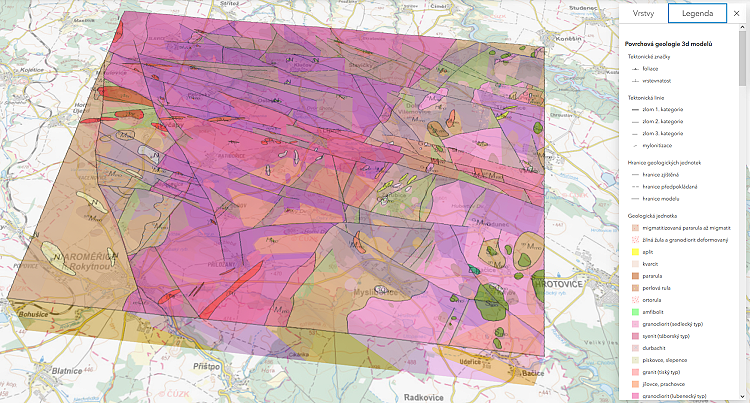
3D geological models of the former HLW deep repository potential localities EDU-West (J. Franěk et al., 2020) and Čihadlo (J. Jelének, 2020) are now publicly accessible through the overview map on the web page https://cgs.gov.cz/en/maps-and-data/3d-models. You can view the models online in your web browser (Firefox, Chrome, Edge, ...) in the 3D scene viewer through the ArcGIS Online service (Czech version only).
The models stem from geological maps 1 : 25.000 created for SÚRAO (Dudíková et al., 2020 and Hanžl et al., 2020). Their primary purpose is to provide a user-friendly access to the geological interpretations of an extensive geophysical and geological research conducted at this site in the years 2017-2020. The models served for the needs of evaluation of the potential locality of the deep HLW repository and the following reduction from 9 to 4 potential localities. In this context the models were used as a basis for subsequent hydraulic and transport models, technical solution of the repository, location of perspective areas for design and geological characterization works, determination of the size and shape of usable rock massif, and for the long-term safety analysis of the given candidate site of the HLW Repository.
In the 3D viewer you can try, for example, your own interactive creation of geological sections of the model in the right toolbar – “Analyzovat” tool – “Rozdělit objekty“ tab.